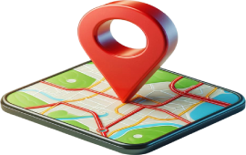
Welcome to Cool Tracking – Where You Learn How GPS and Satellites Keep Us Moving and Safe
Satellite tracking is a system that uses space-based satellites to determine and monitor the location of objects, vehicles, or persons on Earth. These satellites orbit the planet and transmit continuous radio signals. When signals from at least four different satellites are received by a GPS-enabled device, such as a cell phone, a vehicle tracker, or a wearable, it determines its geographical location through trilateration. The device usually then sends this data to a central system or app over a mobile data connection or Wi-Fi. The users can view the object's real-time position on a map. This entire process enables live tracking, route history recording, speed monitoring, and other critical information essential for transport, logistics, and safety, as well as daily smartphone navigation.
How GPS Became the Foundation of Modern Tracking
The Global Positioning System (GPS) is at the heart of many current age-tracking technologies. Studied and designed by the U.S. military during the Cold War era, GPS became operational in the early 1990s and was subsequently opened up for civilian use. It consists of approximately 30 active satellites that orbit the Earth in highly precise orbits. Each of the satellites sends signals that contain information specifying the location of the satellite and the actual time at which the signal was sent. By picking signals from multiple satellites, a receiver on Earth could calculate its position to within a few meters' accuracy. In today's world, GPS is utilized in smartphones, automobiles, aviation, agriculture, emergency services, and scientific research.
How Tracking Devices Work and Transmit Location
A GPS tracker is a device that determines its location using satellite signals and then sends that information to a remote platform. These devices can vary in size and function. Some are built into smartphones, while others are compact units designed for pets, vehicles, or cargo containers. Once the location is known, the tracker uses another network—typically cellular, Wi-Fi, or occasionally satellite internet—to send the coordinates to a server. The server then displays the data through an app or website, often offering features such as live movement, location history, boundary alerts (also known as geofencing), and speed reports. Some trackers update location every few seconds, while others transmit less frequently to save battery life. These systems are designed to work continuously, even while the object or person is in motion, enabling accurate real-time monitoring.
Real-World Applications of Tracking: From Daily Use to Critical Missions
Satellite tracking is now part of everyday life. It helps people find their way using GPS apps, lets parents know when their child's school bus is arriving, and allows pet owners to locate lost animals. In business, it's used for managing delivery fleets, tracking employee movements, and ensuring that assets are being used properly. In aviation and shipping, satellite tracking ensures that aircraft and vessels stay on course and that their movements are monitored for safety. The technology also plays a vital role in public safety and disaster response. Emergency services use tracking to dispatch responders to precise locations, locate missing persons, and coordinate resources during natural disasters. In agriculture, GPS enables precision farming by guiding tractors along exact paths, thereby improving crop yields.
The Role of Tracking in Security and Road Safety
GPS tracking also plays a crucial role in safety and security. In the transportation sector, companies use it to monitor driver behaviour, tracking speed, braking habits, and routes taken. This data enables performance coaching, improved compliance with safety regulations, and a reduced risk of accidents. For vehicle owners, especially those with high-value cars or motorcycles, GPS trackers act as theft recovery tools. If a vehicle is stolen, its real-time location can be sent to law enforcement, increasing the chances of recovery. In education, school districts utilize GPS to track buses, enabling them to maintain route efficiency and ensure that children are picked up and dropped off safely. This visibility gives peace of mind to both schools and families while also making school transport operations more efficient and reliable.
What Happens to Your Location Data
When a GPS device sends data to a central system, that information is stored—often for reporting, alerts, and performance analysis. The data may include the device's coordinates, timestamps, speed, and other relevant information. This information is stored on secure servers managed by the service provider, and it can typically be accessed via mobile apps or dashboards. Depending on the platform, users can view the device's location history over time, generate reports, or receive notifications when the device enters or exits specific areas. However, this constant collection of location data raises concerns about how long the data is stored, who can access it, and how it might be shared.
Privacy Concerns and Ethical Considerations
With the growth of tracking technology, concerns about privacy have also become more serious. When location data is collected without clear consent or misused by third parties, it can create real risks. Governments and businesses are required in many regions to adhere to strict data protection laws, such as the General Data Protection Regulation (GDPR) in the European Union. These laws ensure that users have the right to know how their data is collected, stored, and retained. Users are encouraged to choose transparent tracking services that offer data control options and provide secure access. For families, employers, or institutions using trackers, ethical use is essential.
Limitations of GPS and Improvements Ahead
Despite its usefulness, GPS has limitations. Dense urban areas, tunnels, or thick forests can block satellite signals, causing trackers to lose connection or report inaccurate locations. Battery life is also a constraint, particularly for mobile or wearable devices that require frequent charging. To address these challenges, modern GPS devices often combine signals from multiple satellite systems—such as Russia's GLONASS, Europe's Galileo, or China's BeiDou—to improve accuracy and reliability. Many trackers also switch between GPS and Wi-Fi or cellular signals, depending on the availability of each.
The Future of Tracking in a Connected World
As we move into an increasingly connected future, tracking technology will become more integrated with other digital systems. Smart cities will use it to manage traffic flow and public transport. Health devices will monitor patient movement or fall detection in real-time. In logistics, sensors combined with GPS will track not just location but also temperature, pressure, or humidity—ensuring safe delivery of sensitive items like vaccines or food. Even in sports and fitness, wearable trackers will continue to evolve, offering detailed insights into physical activity, heart rate zones, and performance analysis based on movement patterns. These developments demonstrate that tracking is no longer just about "where" but about understanding behaviour, trends, and context—and utilizing that insight to enhance everyday life.
Why Satellite Tracking Matters to Everyone
Tracking satellite positions helps one navigate both the real world and the increasingly digital life. It is a means of safety, efficiency, and convenience: coordinating emergency rescues through to the delivery of food at one's doorstep. However, with great knowledge comes the responsibility of asking how such tracking data are collected and used, as well as how they are protected. Whether locating and monitoring your fleet for business, keeping tabs on your child's commute as a parent, or simply engaging in location services on your mobile phone, understanding the way satellite tracking actually operates will enable you to think more clearly, safely, and ethically.